In The Beginning . . .
One of the most formative, educational, memorable, and broadening experiences of my life began on the morning of Wednesday 18 June 2008 as I left New Orleans for a summer in North Dakota and environs, not to return to the Pelican State until early August. I was a participant in a seminar at North Dakota State University funded by the National Endowment for the Humanities.
The night before I departed, I had plenty of trouble sleeping, likely due to being nervous about the large undertaking and commitment into which I was about to throw myself. Perhaps leaving the country and spending two months in Mexico studying at ITESM four years before helped me prepare for a domestic expedition of slightly less time and significantly less risk, but I was still nervous like a seasoned performer. Interestingly, I had applied to the same seminar at NDSU in 2004 and was rejected for it, which is what caused me to go to Mexico instead, something that was even far more formative, educational, memorable, and broadening than the North Dakota and Northern Plains experience that begins with this post four years later. By the time I applied for the NDSU-NEH seminar again in 2008, I had the Mexico experience behind me, which helped me perceive and explore in better ways. So, that rejection worked in great ways; I was able to do both things, albeit four years apart.
Although it is possible to drive from New Orleans to Fargo in two really long days, I elected to to stretch the journey out to five days because of various things I wanted to do along the way, especially in places that I had not theretofore visited. As you might expect, many great, useful, and memorable photographs were made not only during the stay in North Dakota for the seminar but also along the ways to and from there (and, yes, I stretched out the return home too, taking a different route southward.)
While in North Dakota in June and July of 2008, I found time to process most of these shots (some of them since reprocessed for presentation here to meet my since-heightened standards), and I sent them out along with descriptions to friends in a series of e-mail messages which were generally well-received. Discussions about these messages with fellow seminarians (I don’t want that word to make it sound like we were pursuing the priesthood, though in some metaphorical way, we were) who really liked the photographs and descriptions inspired the idea of a more permanent form of display of such photographic essays; so, you see, it was among fellow scholars from around the country at North Dakota State University in the summer of 2008 that idea of what became Jimbaux’s Journal three years later was born. So, for you regular readers of this site, the summer in North Dakota was one of the crucibles from which Jimbaux’s Journal would later emerge. Yes, the experience was that important.
Most of what is written below is what I wrote in late June 2008 in North Dakota, modified in various places for context and content. I hope that you will enjoy them, and I hope that you stay tuned for what is to come in the next few days. Thank you.
The Journey Begins
My grand pilgrimage northward to places heretofore unexplored (by me) began on the morning of June 18, and I’ve finally gotten the pictures from day one processed. Of course, the pictures that you see here were all of places to which I had been before. The new places will come later in the messages with pictures from subsequent days.
I left New Orleans at 05:53 that morning feeling quite lousy and tired. I had brought some carrots on which to nibble on the initial parts of the drive.
The first four pictures of the journey were taken at the Morganza Spillway.
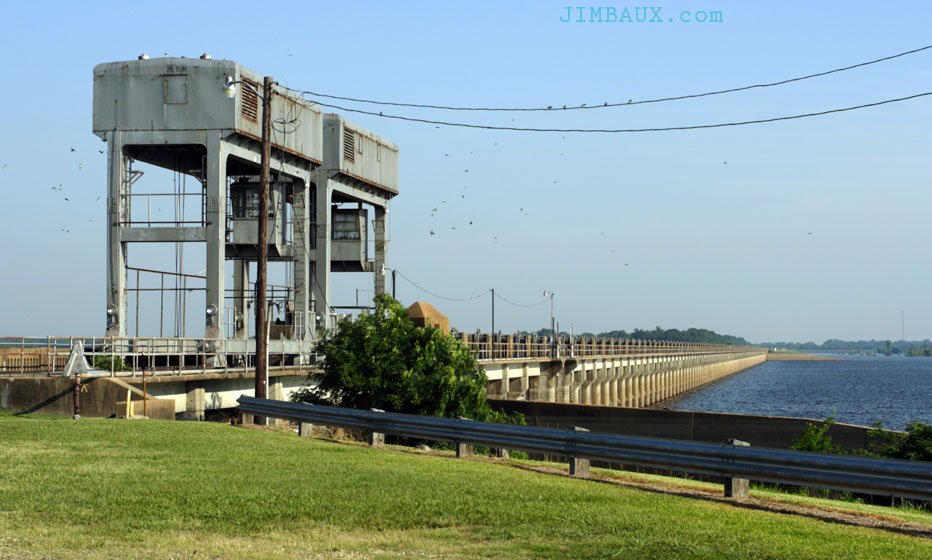
The Morganza Spillway is a flood control structure for the Old River and the Atchafalaya River, the main distributary for the Mississippi River, and what would be the Mississippi River today were it not for the Old River Control Structure to the north.
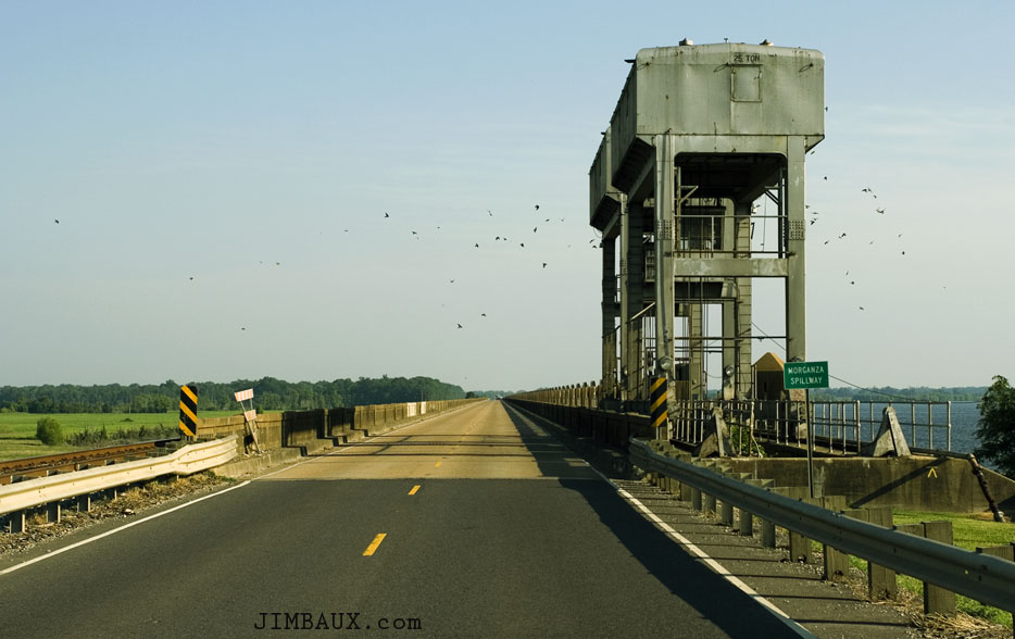
The below shot is the first of many shots you’ll see from this trip that were taken in motion.
Notice the track of the Kansas City Southern Raiway’s New Orleans Subdivision at the left of the road.
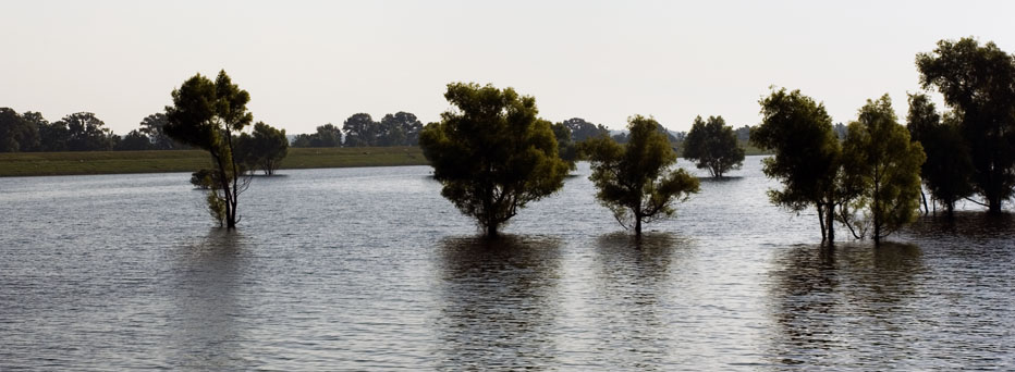
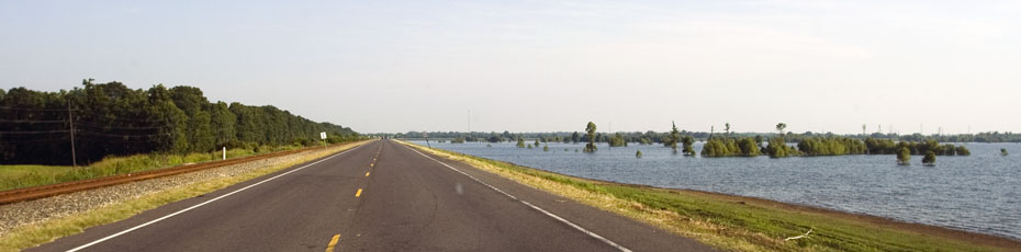
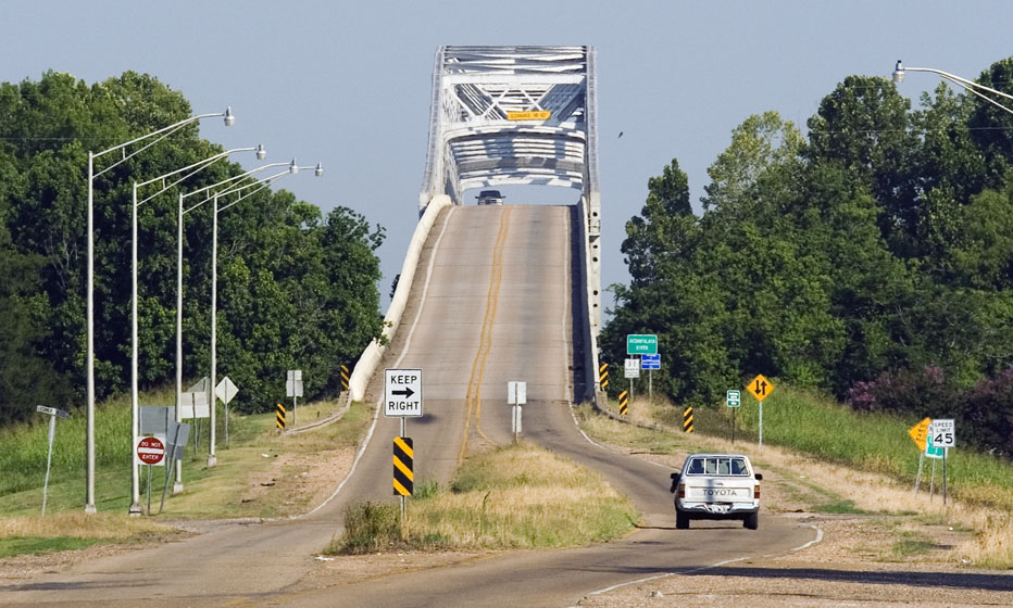
Let’s have a quick look at the eastern approach for the Atchafalaya River Bridge on La. Hwy. 1.
We’re not even in northern Louisiana yet, but it would be several hours and a couple hundred miles away in another state before I’d take the camera out again.
In the meantime, I was damned tired, and I was weary of eating carrots. As much as it shames me (stop laughing, TS), I had to stop at the McDondald’s in Marksville, La., in order to keep myself filled and awake. After that, I rushed to Shreveport and got to the Whataburger on the north side of town for lunch, my usual stop. Yes, after all of these years, I still find the need to humor my stupid traditions. I had the Whatachicken, and it was damned good. After that, it was time to go and check out what was happening at KCS’s Shreveport Yard. Then, I took The MEXLIST Man’s route through northeastern Texas (Marshall, Jefferson, Linden), getting gasoline at New Boston, and arriving back at US 71 at DeQueen, Arkansas. Given the new loops built near Texarkana, I’m no longer convinced that The MEXLIST Man’s route is the quickest, but it, too, was getting to be a tradition of mine.
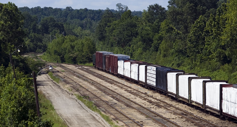
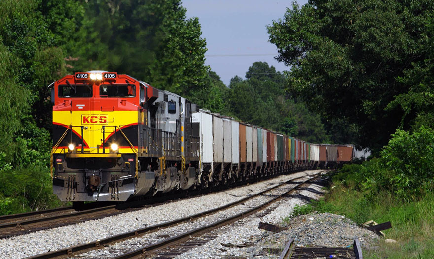
When I arrived in DeQueen, I was still pissed off and cranky as I had been all day, but all it took was some relevant comint to finally get me in a good mood for the first time in this trip! It was getting to be around 16:00 or so, and KCS Console 2 was talking to a KCS 4105 north. A Retro-Belle; sweet! Better still, he was to meet one (or maybe two) at DeQueen, and this would give me a chance to finally do so overhead shots into the yard. I’ve been wanting these shots for years now, and I finally got them on this day.

That was a view toward the south from the overpass, but let’s have a look northward toward an interesting-looking cut of cars that shows some cars loaded with building materials, which I think come from the DeQueen & Eastern railroad here.
Here comes the G-MXKCS (Grain – Mexico to Kansas City, Shuttle) on its way back from delivering grain to the ever hungrier Mexican market.
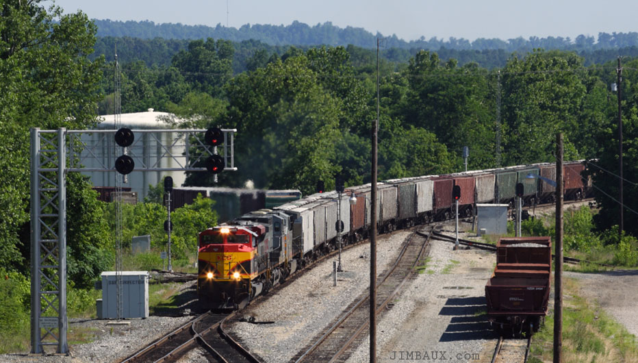
Do you see the DeQueen & Eastern interchange in these pictures?

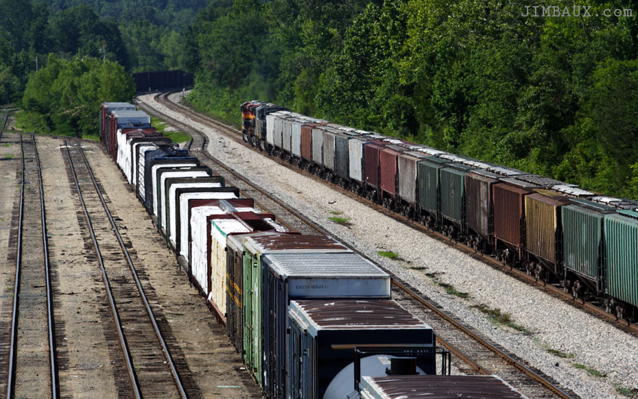
In the below picture, the seasoned observer of KCS’s Shreveport Subdivision will immediately notice the loads of gypsum boards in that cut of cars in the yard.
Since this train was heading north, and since I was likewise, a chase was on!
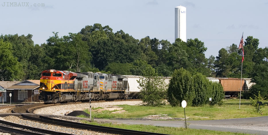
Here we see the G-MXKCS at Gillham, Arkansas, a neat little town.
Hey, there is at least one CAGY car in this train!

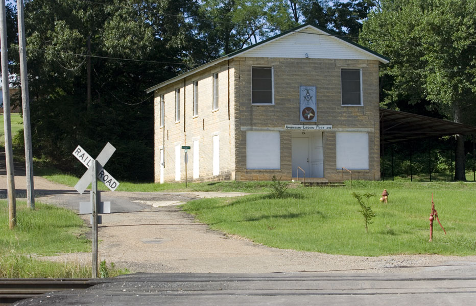
Yes, let us get a shot of that American Legion Post building before we leave town.
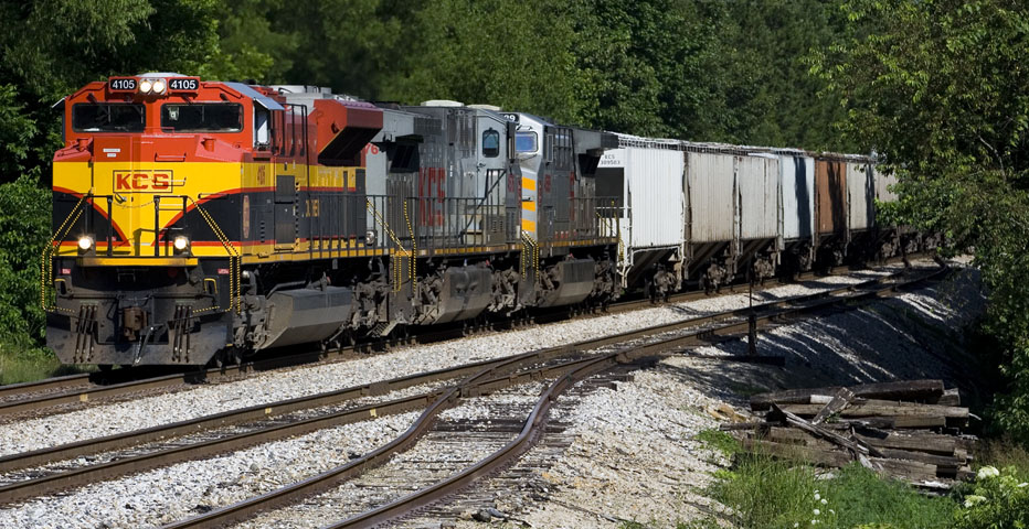
Now, further to the north, we see the train round the curve at Wickes.
The last time I was here was in October [2007] when Whiskey, TS, and I were waiting on a southbound loaded rock train just on the outside of that curve. That was a fun day!
I’ll also never forget riding through there with The Shadow Warrior in February 2003. Slightly more than 10 years later, he would be dead, and, if you have the time and haven’t already seen them, you’ll want to see my pictures of Shawn and The Mid-City Marine on Rich Mountain in February 2007.
We’re in Vandervoort!
No, guys, as you can see, I didn’t do the tree shot this time. For one thing, it was awfully foliated, and for another thing, I was wearing shorts! Yes, I know the lighting for that shot is better in the summer, but I really didn’t care. As you can see, I got an equally lit shot.
Now, it was time to break away from the train and take the shortcut around the back of Rich Mountain. While there, I took a few cow pictures.
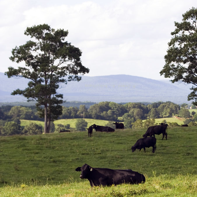
We’re on the border between Arkansas and Oklahoma, and I’m not sure what state this is. This is the Ouachita Mountains, a truly neat place.
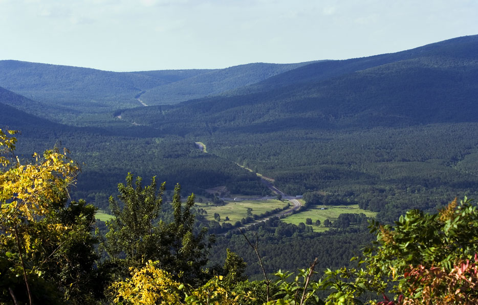
US 259 in LeFlore County, Oklahoma, just south of Page is a spectacular drive.
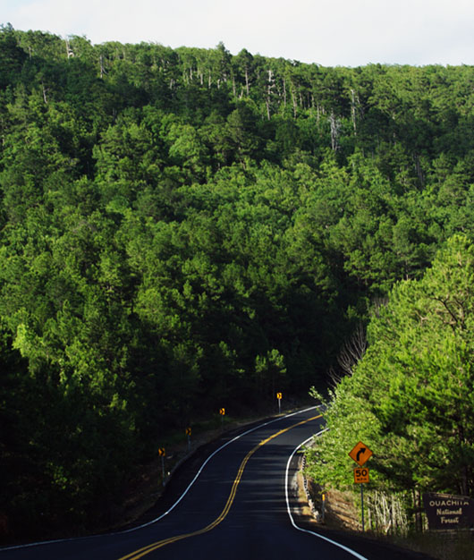
Not all of Oklahoma is flat!
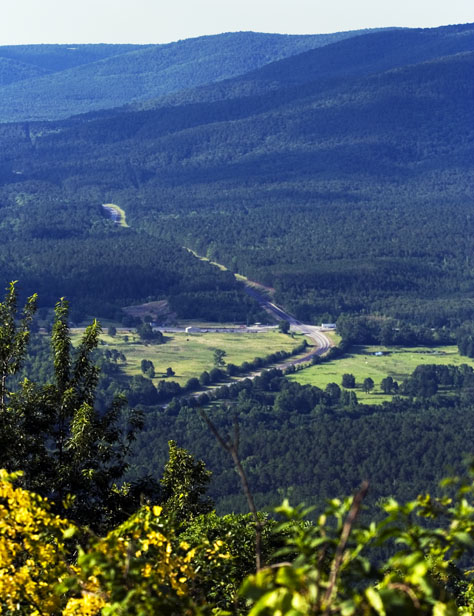
There are several places where gearing down while driving is highly desirable.
We’re finally in Heavener! I love that place. For those uninitiated among you, when trying to pronounce the name of the town, instead of being tempted to say “heaven,” say “heave” instead, and you’ll understand how it’s pronounced with the long “e” sound.
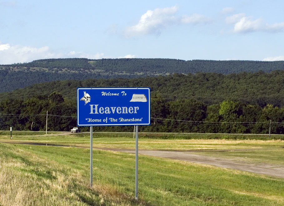
The “runestone” you see mentioned in the sign tells of a rune carving at the top of the hill that you see behind the sign, which I photographed here in October 2006. I’m a bit skeptical myself, but some believe that Vikings came this far south and made carvings on the mountain. I’ve seen the carvings, but, as I said, I remain unconvinced. More importantly, though, I love the view of the town from the top of the hill, and, as I showed you in the posting of 31 March 2012 pictures, I finally returned to this place nearly four years later for the first time since these images were made.
Oh, the last shot shows yet another northbound empty grain train.
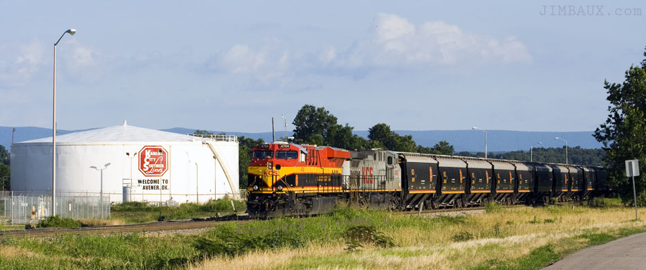
Heavener is a terminal for the KCS, and you can see the diesel tanks on the side of the locomotive.
So ended Day One of the trip, after a trip to Braum’s in Poteau and a shower in the hotel in Heavener. I was exhausted. Today’s shots weren’t spectacular. What would tomorrow bring? More of the same, unfortunately, but fear not, for things will get better, but not quite like some of you might expect.
Stay tuned for day two’s shots. Until then, Jimbo out . . .
{ 1 comment… read it below or add one }
Beautiful pictures. The scenery looks absolutely stunning. Nice to find out I knew how to pronounce Heavener correctly!
{ 4 trackbacks }