[Jimbaux sent himself searching.]
A Rare Find
11 January 2014
‘Twas a special day indeed! Knowing that my chance to do these long, out-of-the-way, day-long foam trips well into Mississippi would soon come to an end, and wanting to really see and photograph some action on most of the former Gulf, Mobile & Ohio Railroad line in and north of Bogalusa, Louisiana, I decided, despite the dangers posed by the pre-dawn rain storms, to make the effort. I made the trip on Saturday 11 January 2014, one week after Nitro and I caught the KCS DeLisle Job in Gulfport and two days after I caught the KCS Gulfport Turn doing the interchange in Hattiesburg.
Background
The former Gulf, Mobile & Northern (and former New Orleans and Great Northern) mainline once extended from Jackson, Mississippi, to Slidell, Louisiana, and, via trackage rights on the Southern Railway (much of which included the bridge over Lake Ponchartrain), into New Orleans, where it connected with several other railroads; the line became part of the GM&O when that railroad was formed with the 1940 merger of the Mobile & Ohio and the GM&N. The end of its use as a through route came not long after the Illinois Central Railroad purchased the GM&O in 1972, creating the Illinois Central Gulf Railroad.
Since IC had already had two mainlines into New Orleans, and since one of them reached New Orleans on a shorter and better route from Jackson, the former GM&O line through Bogalusa became, almost immediately after the 1972 merger, a route only for local traffic, and the segment north of Wanilla, Mississippi, was soon abandoned, as the IC was able to reach Wanilla and the line south of it through a line extending eastward from Brookhaven. The line south of Bogalusa to Slidell was not abandoned until 1994, and partly because the Shoreline District – a branchline to Covington and Abita Springs – lasted until about 1990. When the rails south of Bogalusa were removed, the line to Bogalusa itself became a branchline, serving a large paper mill, the ownership of which has changed over the many years of its existence and is today owned and operated by International Paper; forest products, from the line’s inception to the present day, are its reason for existence.
The line today has a very branchline quality, with jointed rail, relatively short above-the-ground portions of the roadbed, and one train per day, but there are pieces of evidence of its former status as a mainline, even though one that was never supremely busy, as the line was built for the purpose of transporting lumber from the Bogalusa area. All of this combined with its relative obscurity – a characterization that I make partly because I have seen almost no photographs taken of action on the line, a long time ago or recently, and, believe me, I have looked – is part of why it appeals to me so much; if nobody is really, seriously photographing action on this line (or even not-so-seriously photographing it), then perhaps it is my duty to do so. Another very appealing quality of the line is that seeing car types other than boxcars and centerbeam flatcars is rare, and these happen to be among my favorite types of cars, for the boxcar, because it is so traditional and since cars are usually railroad-owned, a relative rarity today.
Mission Defined
From some well-placed sources, I had gathered some intel – that proved to be credible – about operations on the line, and I hoped to do better than my two previous trips to the era five years before, the first in December 2008 when the only moving train I photographed was the mill switcher, and the second a month later in January 2009 when I got the turn returning to town.
Mission Not Aborted
I survived the rain, which began to abate once I got north of Pearl River, and I arrived in the interesting city of Bogalusa as darkness was beginning to yield to a very grey lighting.
Yes!
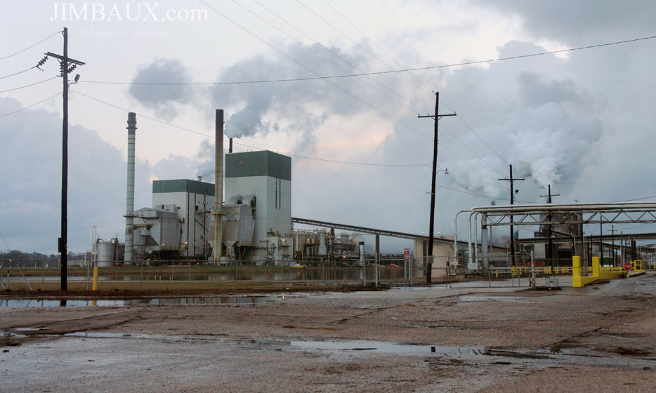
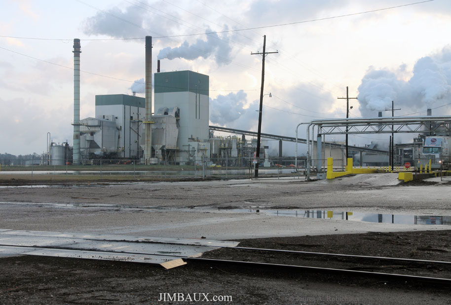
You haven’t seen any of the city itself yet (yes, we’re inside of the city, but I think that you get what I mean), and the few photographs of the city that I will show here will not do the city justice; isn’t it neat and interesting, however, the way that a city or town is identified with its main industry?
More can be learned about Bogalusa by reading the Wikipedia entry on the city.
I don’t know what is happening or how it happens in this pictures; anyone with knowledge of the paper-making process is invited to explain in the comments section what is happening in these pictures.
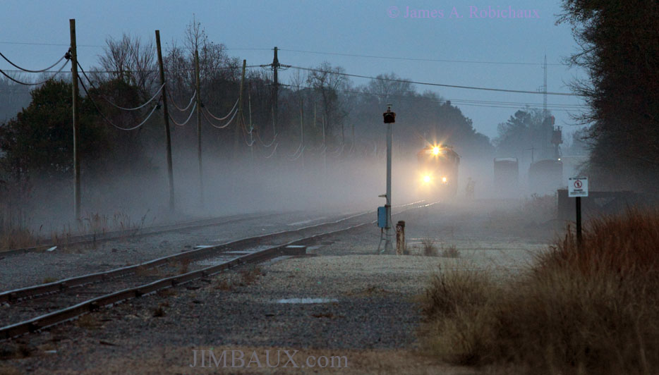
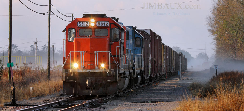
You’ve seen a few glimpses of the railroad already, and now here is your first glimpse of the train – or what will be our train.
The fogginess of this morning – and the fact that it seemed that the rising sun would burn it off quickly – only made this experience more invigorating! The ground and the roads were wet, but they were quite usable, and I was thrilled to be here.
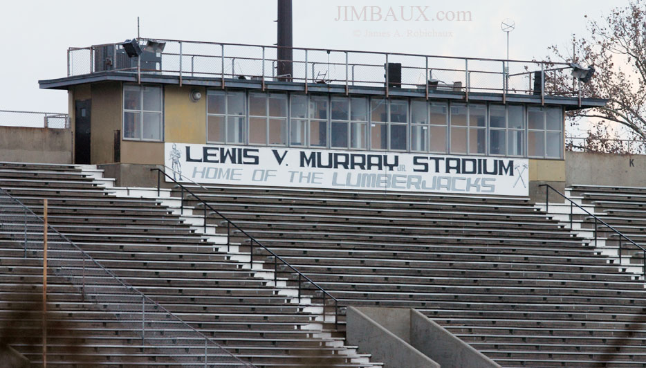
Looking the other way, we see the high school football stadium; the track is between the stadium and the mill!
That is (part of) what is so neat about this place: all of the towny elements – railroad, school, main industry – are in such close an intimate proximity, meaning that they are inseparable parts of one story!
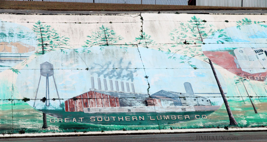
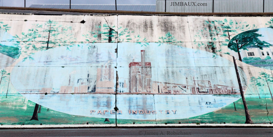
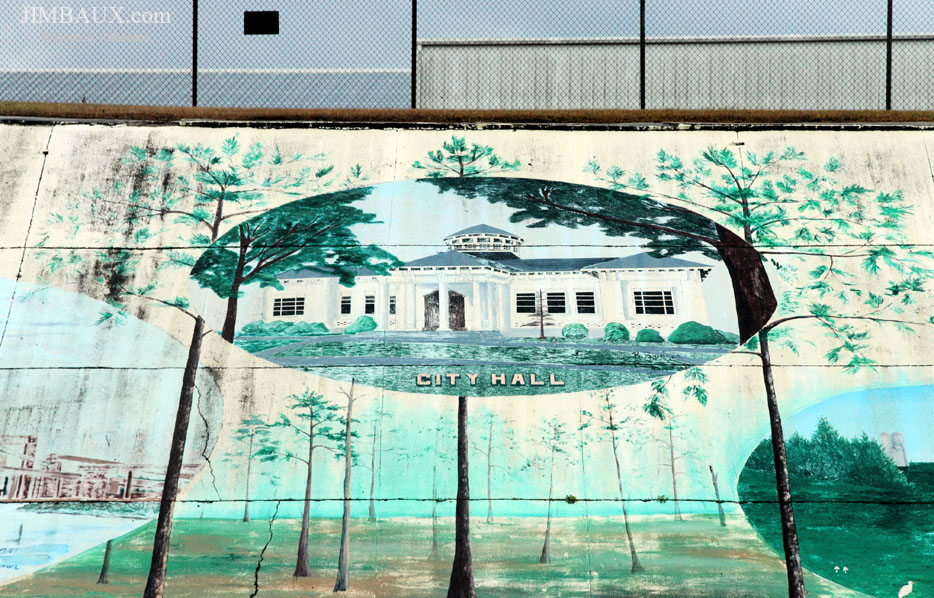
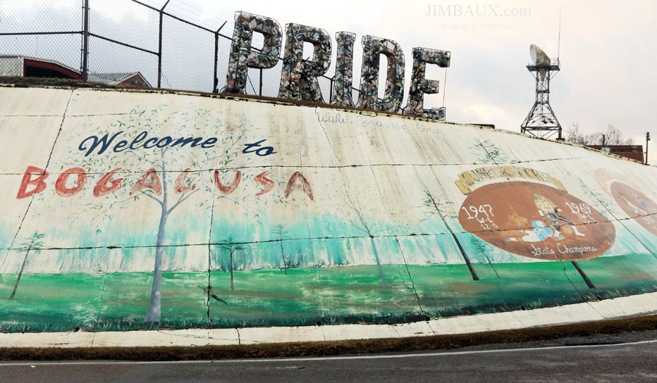
Moving a block to the north, to the other side of the stadium, we see this neat mural that tells so much of Bogalusa’s history.
The Great Southern Lumber Company was the reason that Bogalusa and the railroad that serves it exist at all!
Note the Rebel passenger train, of which many in Bogalusa were proud.
This mural is so neat! I’m guessing that some group of students at the high school one year did this as a project, perhaps under the direction of an art teacher.
Note how the background behind each piece in the mural shows a pine forest.
Perhaps that pine forest background is a powerful metaphor, particularly because Bogalusa’s “background” is the forest; not only does the local economy rely on forest products to this day, but pine forests were what preceded the town, gave birth to the town.
Apparently, the Lumberjacks football team was state champion in 1947 and 1969.
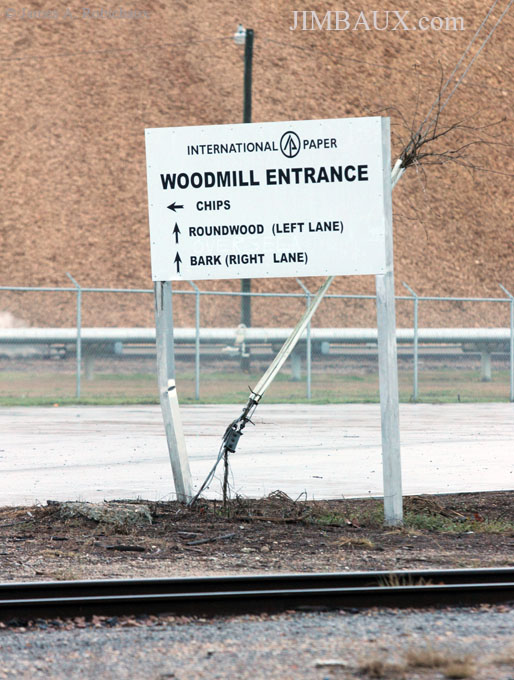
Something, I do not know what, but, perhaps, radio chatter, drew me back to the mill entrance over the railroad track.
Somehow, I must have gotten the impression that the train would soon leave.
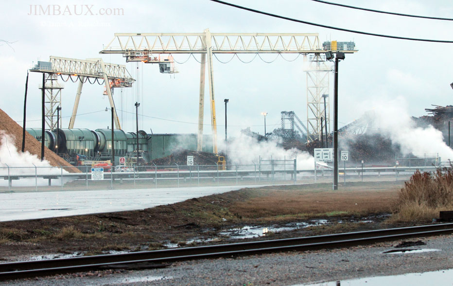
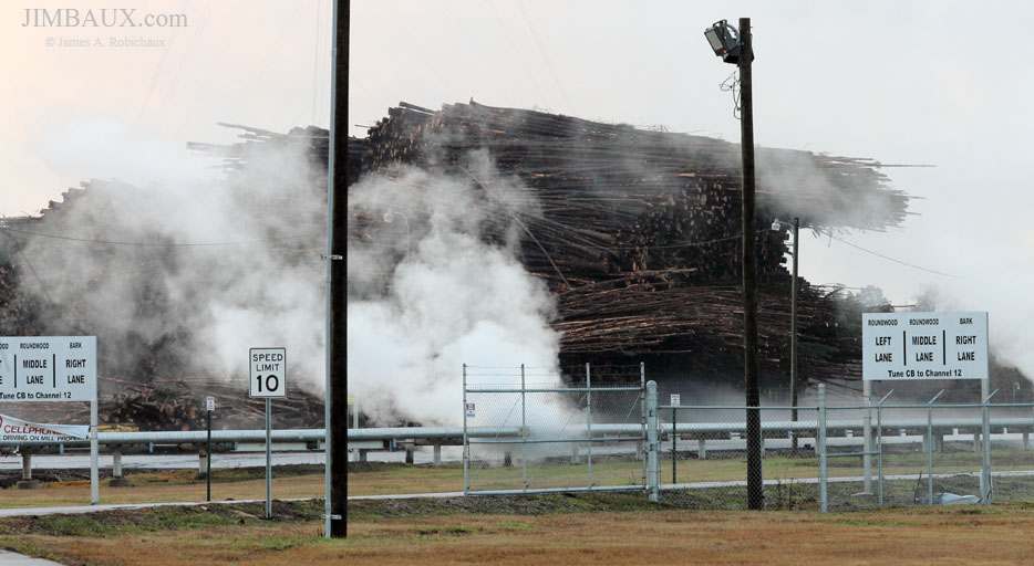
So, here are a few more mill scenes before the train departs.
That’s plenty of pine!
Well, now it is train time.
It’s Happening!
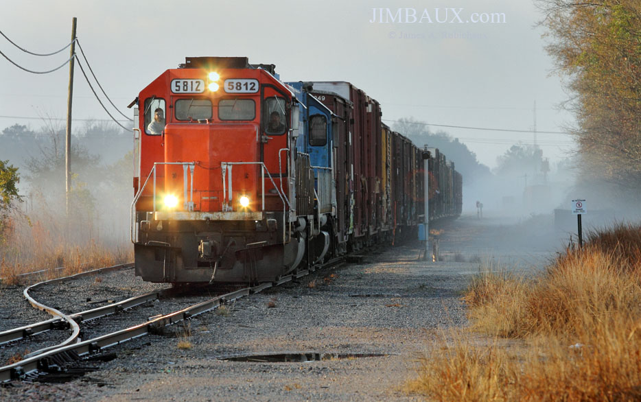
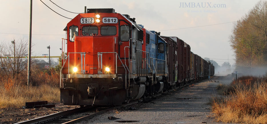
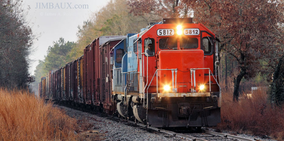
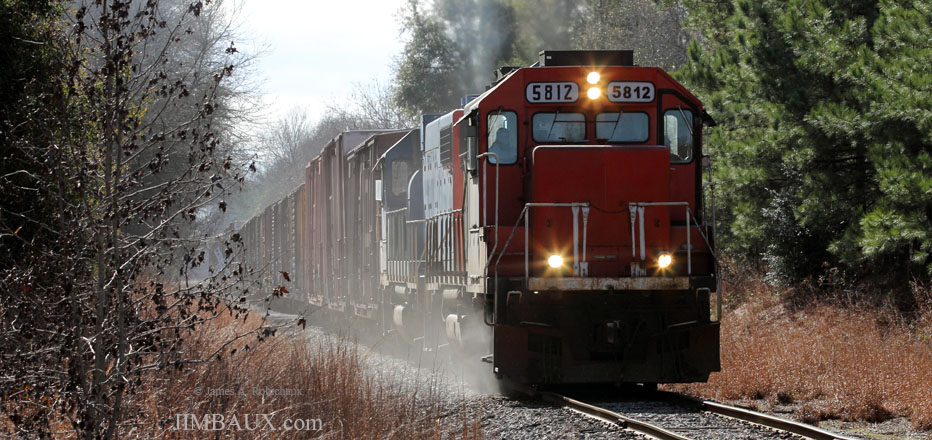
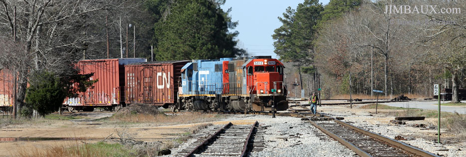
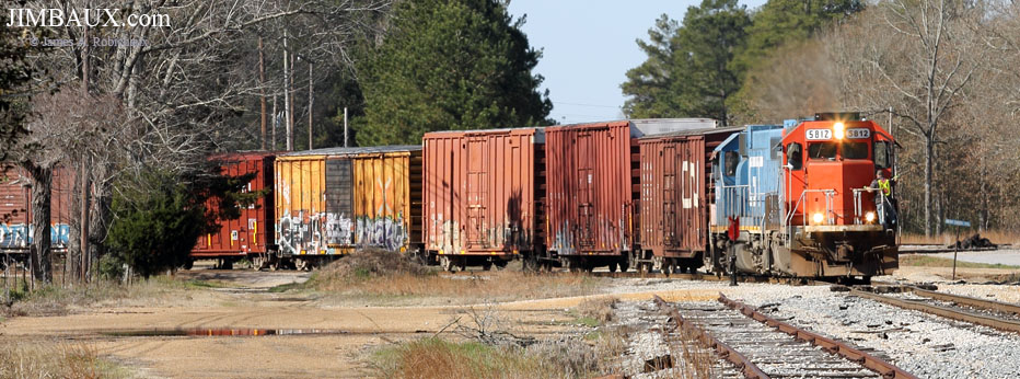
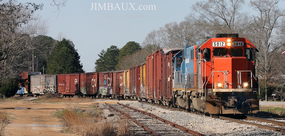
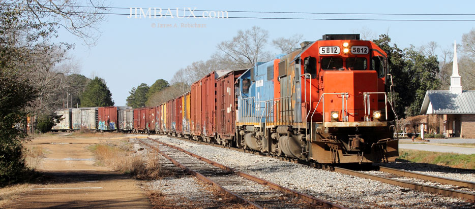
So, here it is, at 07:48 on this Saturday 11 January 2014, our train – Canadian National Railway train L579 – is departing.
Yes!!! A train with only boxcars and with four-axle locomotives with hood-noses is the way a train is supposed to be, how Jesus wanted a train to look, or, at least, this is as good as it gets on a Class I railroad in 2014; well, I wouldn’t mind a couple of railroad-owned flatcars and railroad-owned hopper cars in the train too!
Even with some sun rays making their way through the clouds, the backlighting here just works, partly thanks to the not-completely-burned-off fog.
I am pleased, both with these images so far and with the promise of many more pictures thanks to me being trackside when this train’s run begins (as opposed to the one previous time in January 2009, when I caught it returning to Bogalusa.)
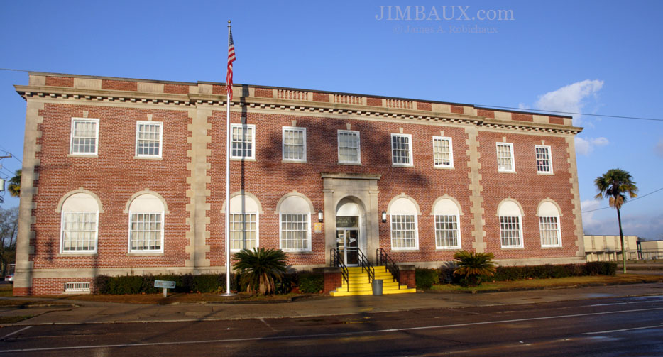
As we depart the middle – or this part of – town near the high school, we catch a glimpse of the post office.
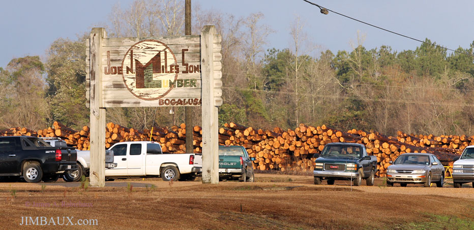
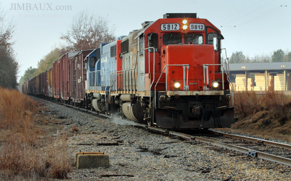
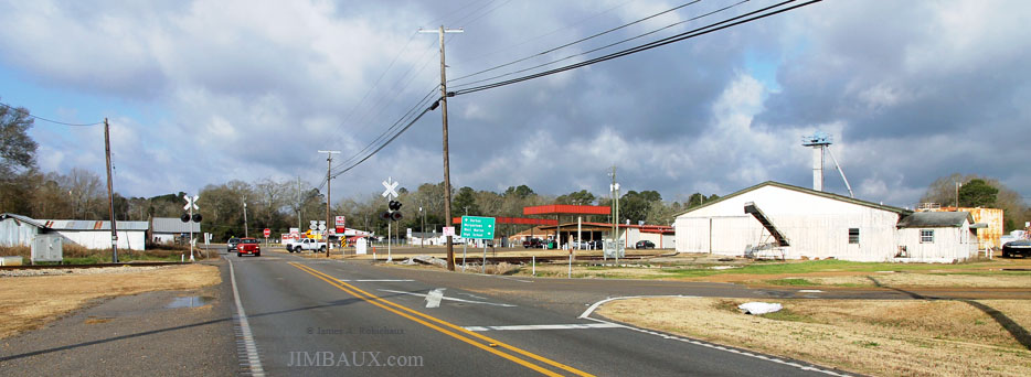
Next, we are at the edge of town, where the major highway that rougly parallels the track crosses the track right next to Joe N. Miles Sons Lumber, the only other remaining railroad customer – shipping a few loaded centerbeam flatcars per week – on the Louisiana portion of this line.
So, here we will see a couple of views of the train passing this location.
I like that. I like it much better than the poorly lit and not-so-well-composed shot below, but I present this image because it shows the Miles lumber mill next to the track, along with what appears to be an old, no-longer-used signal base next to the track.
That blast of sand is a nice touch too!
The Northeastern Most Part of The Southeastern Part of The State
Next, we are in – or, at first, near – the community of Varnado.
The following sequence of scenes from the middle of town is perhaps my favorite of this entire large set.
And the below image is perhaps my favorite of the entire set.
I am not sure why or how, but, to me, this image just as a very GM&O feel – and a very rural Florida Parishes feel – to it; how I, someone who had no personal recollection of the GM&O, a railroad that lost its existence long before I was born, can have such a feeling is perhaps a testament to the degree to which both railroad enthusiasm and a sense of history can affect someone to his core.
Surely, especially for the people who live there, there is far more to Varnado than what you see – or what I see – here, but what I see here is pleasing.
Where Will It Lead Us From Here?
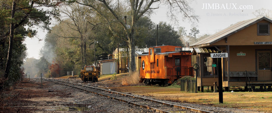
Next, we are in Angie, the last town before we cross into Mississippi. Check out the old ICG caboose!
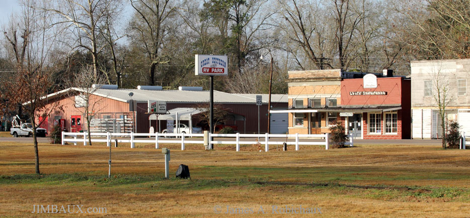
The depot that you see in the picture there is not “historic,” at least not to this location, as it is part of an RV park just next to the track, which we see as we turn to the right.
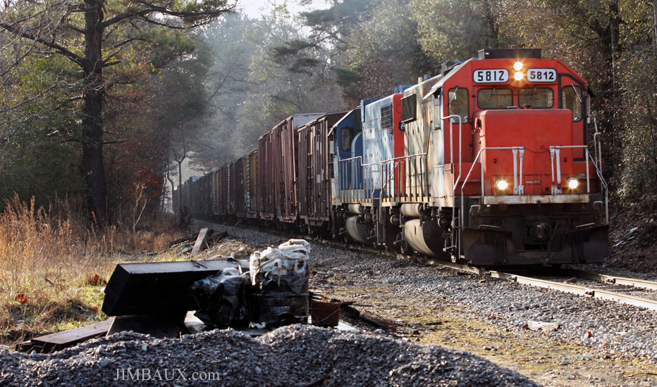
Okay, here is our train.
That’s all for Louisiana for today!
Entering The Magnolia State
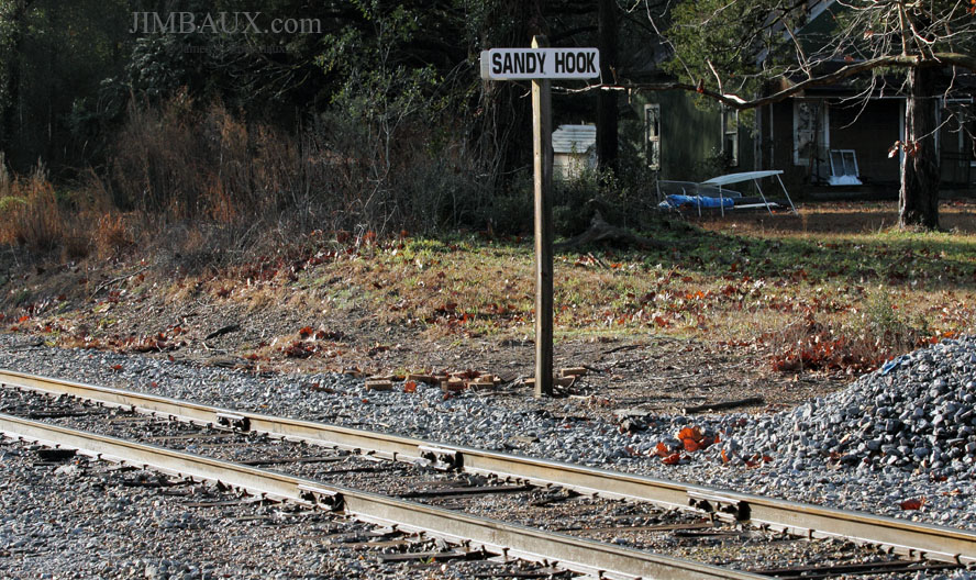
Next, we are in the neat little Hamlet of Sandy Hook, Mississippi.
Well, the train is coming.
The station sign seems different from when I photographed it in 2008.
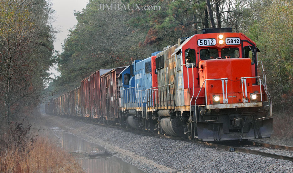
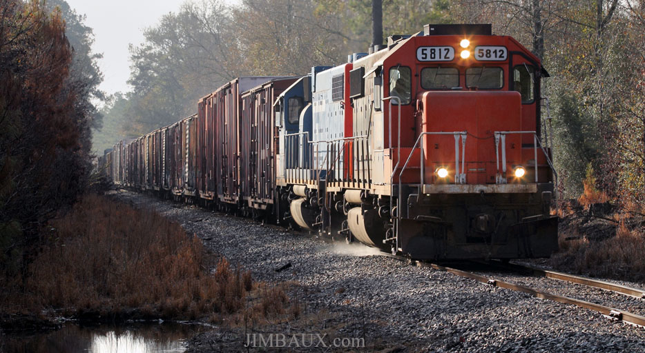
Further north, with the lighting becoming more problematic, we are in a piney area called Pickwick as we see the lead locomotive again shoot sand.
The piney woods and tree-lined right-of-way make any types of pictures other than nearly-head-on-telephoto pictures – like you have see everywhere but Varnado, so far – very difficult; in Mildred, I was able to momentarily break that cycle once again.
Just north of there in Cheraw, I gave up on trying to get an image that was primarily a train image.
This is to be expected when the train is traveling mostly northerly and slightly westerly in the late morning.
You Know You’re A Redneck If . . .
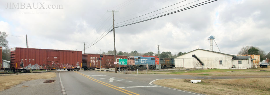
Now, we are in Foxworth, a place where there is a small siding today and evidence of a former passenger station.
Apparently, the building at right was at one time a railroad customer. The clouds arrived right before the train did.
Oh, well.
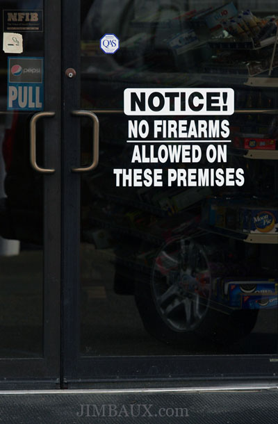
At this point, I stopped at the store next to the track here for some badly needed intake and expulsions.
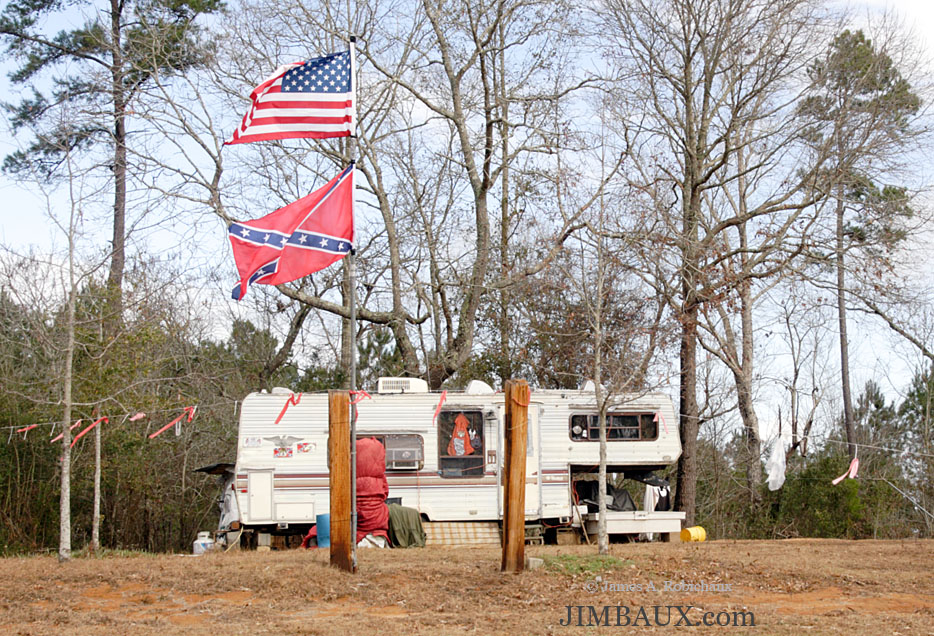
Wow, apparently, bringing guns in a store is a problem here! Seeing some toothless white people inside did not really help my sense of welcome; indeed, it was a very Foxworthy experience!
However, this place makes hot food, and I got some bacon biscuits and took my sweet time.
Indeed Red, and Indeed a Bluff!
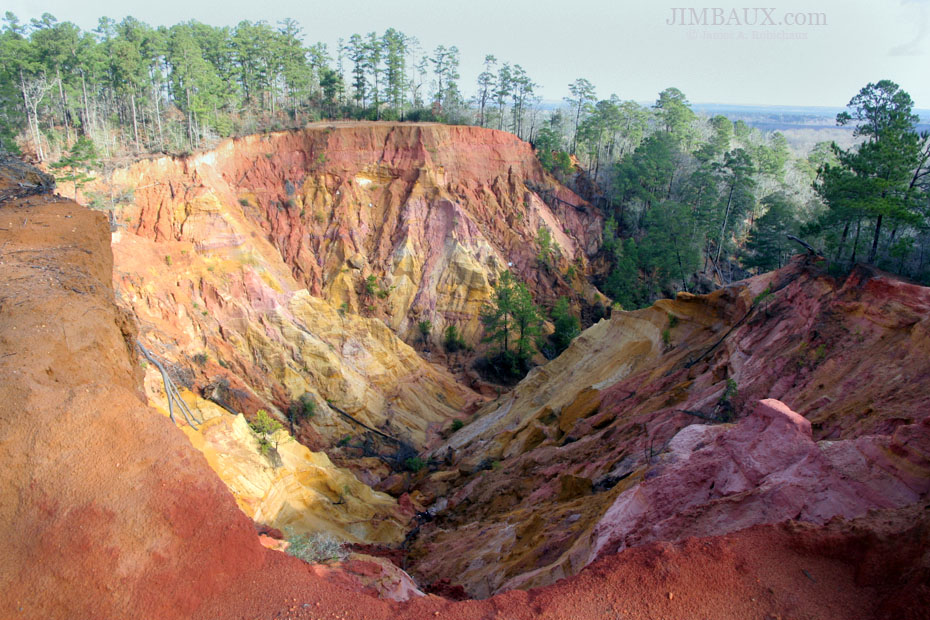
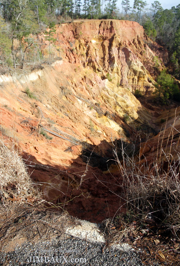
I tried to find some high views of the track at a place called Red Bluff north of Foxworth, where it appeared that part of the old highway went, but I only found this instead.
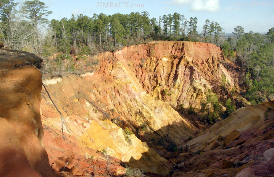
Whoah! Now we see why the new highway bypass was built! Yes, that is essentially the edge of the road that you see at the left, both in the foreground and in the background.
Apparently, some landslides occurred here recently.
Yes, in the below picture, that is a white former edge-of-road line that is now the top of a cliff!
Wow!
Here’s a little settlement at Red Bluff.
Well, that’s interesting; so, too, was the highway from there to Morgantown, where I arrived approximately five seconds too late to shoot the train moving past the station sign, but if you had the impression that I didn’t really chase the train from Foxworth to Morgantown, that would be correct.
After Morgantown, the highway – well, more specifically, driving – becomes even more interesting!
These Parts Are Interesting
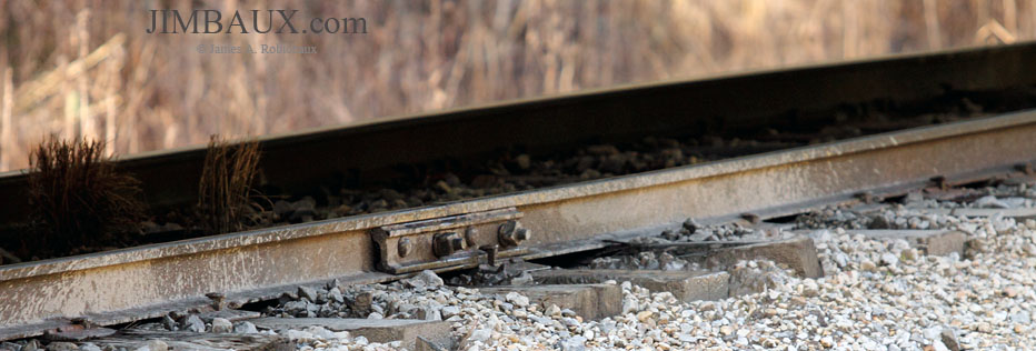
Somewhere much further north, in the hilly region north of Morgantown, we stop to observe a pair of pictures showing how this old jointed rail moves downward as the train passes.
That’s really all that I could do in this very interesting but very difficult-to-photograph (a train) area.
The next actual town was Monticello, but we are still several miles from there, and we’re in a hilly area with almost no access to the track. So, all that I can do is pop off shots like this.
Looking at the locomotive in this picture, you might get your first clue why I decided later to not come home the same way that I arrived.
Nine minutes later, we are on the southern outskirts of Monticello, where we are still challenged by inopportune orientation of the train in relation to the sun.
Yeah, that was lame.
Not Like Thomas Jefferson’s House
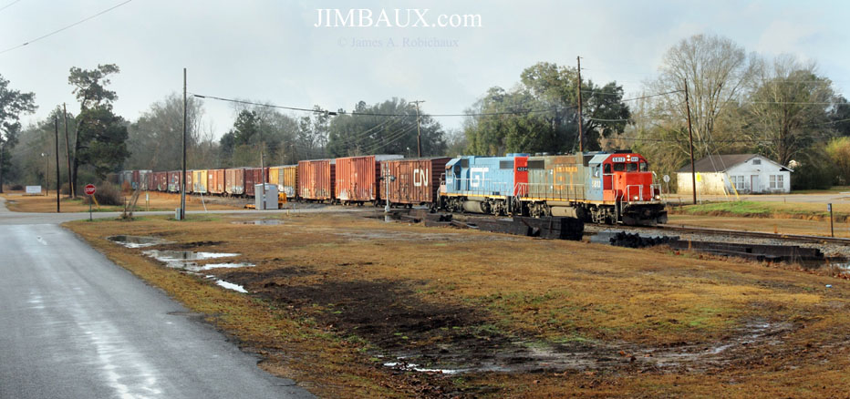
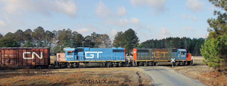
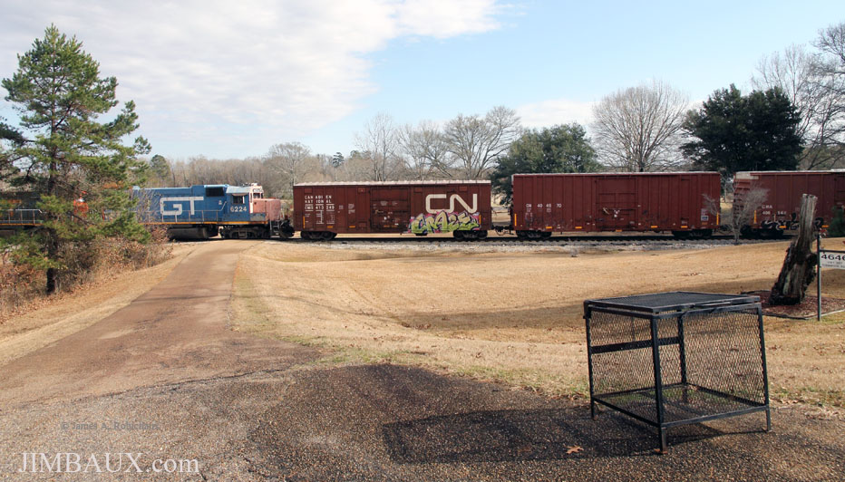
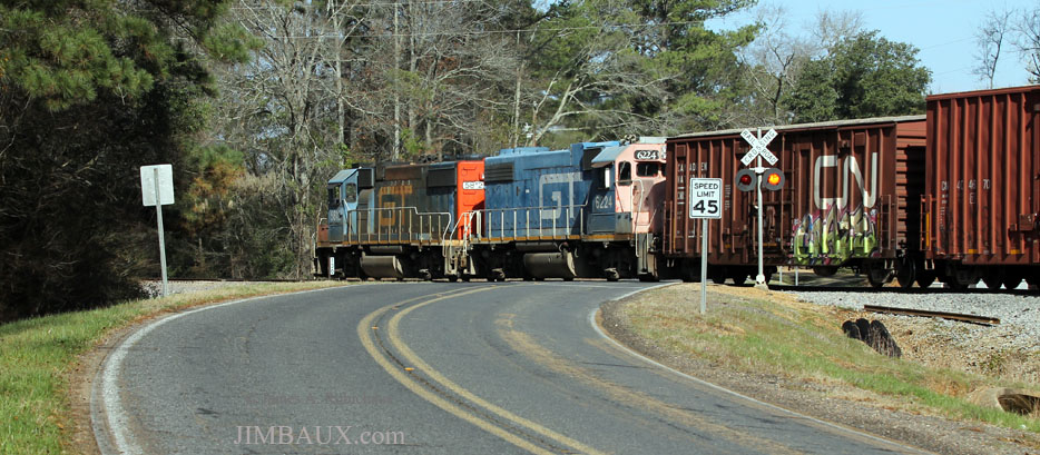
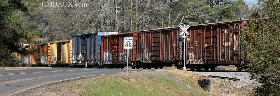
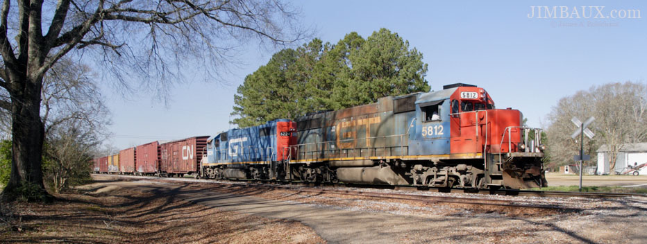
Heading northward into the city of Monticello, the highway, which is to the west of the track south of town, crosses the track. At this location, I thought it appropriate to make several views of essentially the entire train.
How was that? Note that the vast majority of the cars were CN family cars; the non-CN cars might have been two Railbox cars and one NS car.
As I drove through Monticello (and was unable to get ahead of the train), I noticed that there was a Ward’s restaurant in town; that information would be very useful in my next visit here 11 months later.
Whassup, Nilla?
I arrived in Wanilla, a very interesting place.
Wanilla is where the east-west-running Mississippi Central crossed the GM&O (and GM&N, and NO&GN); today, the diamond remains, but the Georgia Pacific mill just a few miles to the east and across the Pearl River at Ferguson is the only remaining customer in the area. When the train from Bogalusa arrives at Wanilla, it turns eastward onto the old MC to go to Ferguson where it will set out its outbound (from Bogalusa) train and pick up its Bogalusa-bound traffic; any traffic to be worked by the southbound train – for Miles lumber, for a sawmill at Monticello, or for one or two pulpwood yards – is on the front of the southbound train.
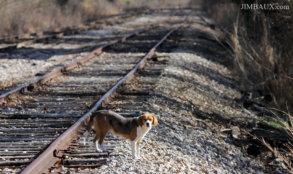
Wanilla seems to have a high per-capita (the human kind) population of dogs.
In the above view, we are looking eastbound, Ferguson-bound, on the old Mississippi Central while we await the train.
Okay, so, here we see, looking in the opposite direction, the train turning (via the connecter track) eastward from the mostly north-south GM&O route to the mostly east-west Mississippi Central route.
You can see the diamond in the background of the above image; you can see Conductor Johnson on the ground in the below two images.
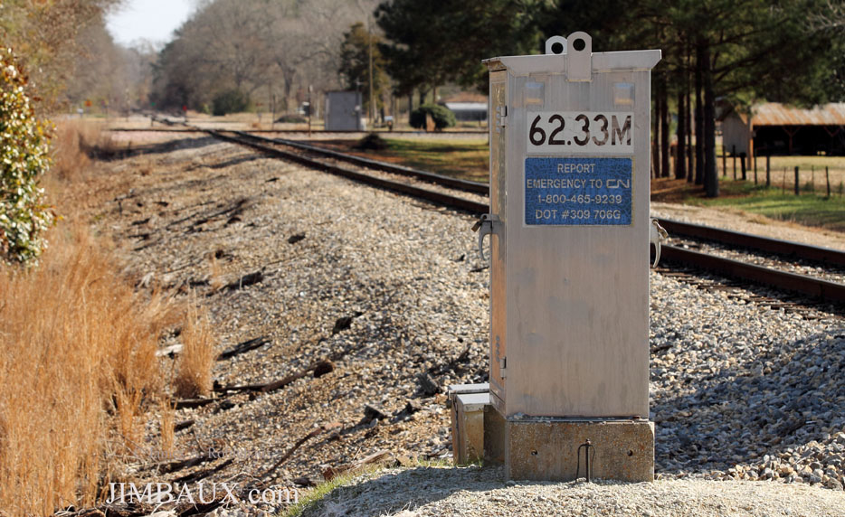
Note the milepost 62, which is measured from Hattiesburg; that connection was severed decades ago.
The former Mississippi Central west of here, however, is still in existence, all the way to Natchez.
Yes, the next picture is one that many of you have seen already.
That night, shortly after I got home and shortly before I fell asleep, I posted to the Facebook page a version of that picture, along with a brief description of the day.
One purpose of showing the below image is the showing of the church in the background.
And, here is one wide-angle shot, as the train slowed to a stop so that the crew could learn who on Earth had been chasing its train all this time.
The conversation reinforced my assumption that nobody else ever foams this line, perhaps ever; it is as if I have a duty to have done what I have done here.
Well, that’s all for the train in Wanilla for now, but we and the train will return shortly.
Lord, Give Us A Sign
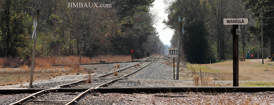
Before we leave Wanilla, we need to observe the revealing signage. Here we are looking southward along the former GM&O mainline (with the former Mississippi Central mainline to Brookhaven and Natchez cutting across the width of the frame), with the mileposts measuring from New Orleans.
You’ll note in the left background the connecting track that the Bogalusa-Ferguson Turn uses.
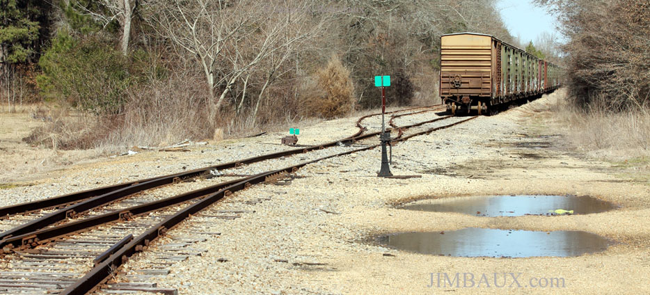
Looking in the other direction, along the mile or so of track that remains north of the diamond, we see British Columbia Railway boxcars in storage.
I feared at the time that these were just being stored here prior to being scrapped; I have no idea what has become of them.
From the highway west of Wanilla, we look down the Mississippi Central trackage to the east.
We are now leaving Wanilla, but we will soon return!
Ferguson
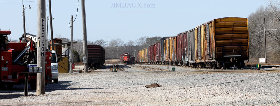
Next, we are in Ferguson, where we will end this article, to be continued in the next article.
Here, we see our train arriving at the small yard at Ferguson, on former Mississippi Central trackage.
Apparently, the outbound cut that the train would pick up is the set of boxcars at right. The mill switcher to work the Georgia Pacific paper mill just to the left must have been working in the mill.
Did you catch the reference to a Rolling Stones song earlier in this piece?
That’s all for this episode, as this is plenty enough pictures for one post; next, you’ll see one more scene of Ferguson, and then a few more scenes of the southbound train at Wanilla and places to the south before we break off to go west.
Stay tuned!
Jimbaux



















{ 5 comments… read them below or add one }
Interesting coverage, James, topped with unique photos.
The Mildred shot was probably one of my favorite.
I think it’s cool that you took the time to research and log all this information, both in written and photographic form. Closest think I can think of here would be me chasing “the Hearne Local” but it runs on a busy main, and is surely one of many Hearne Locals that operate in all directions (the symbol eludes me, LAB 46-XX perhaps). True branch railroading at its best!
The red bluffs, and even that retirement home, were also interesting shots that are surely unique to the area.
Thanks for sharing!
Nathan Kaufman
Why didn’t you call and come over??
I figure that most people don’t like visitors at five o’clock in the morning, and even if you did, I’m not a super-early riser, and it was difficult enough for me to get up early enough to make the drive from New Orleans to be in Bogalusa for dawn; so, I’d have had to have gotten up even earlier and left even earlier to have come and visited you!
Superb essay and great photos of a classic operation. Thanks for preserving and sharing this!
{ 2 trackbacks }